Walker County Has No Zoning. That Doesn't Mean No Risk.
August 13, 2026
August 13, 2026
A land brochure crossed a desk not long ago for a tract in south Walker County, a few miles off I-22 near the Cordova-Parrish exit. Buried past the acreage, the timber count, and the driving directions was a line most buyers skim past: portions of the property had been strip mined for coal and reclaimed, and the buyer should expect the possibility of subsidence, thin or rocky soil, and health department pushback on a septic permit.
Nobody flagged that for the seller. Nobody has to. That single paragraph is the whole story of what buying land near Jasper actually involves, and it is worth understanding before you write an offer, not after your septic percolation test fails.
Scroll through land listings around Jasper and you will see the same phrases again and again: unrestricted, no zoning, no covenants, build what you want. Walker County's own engineering department confirms it in plain terms. The county says it currently has no zoning rules or regulations except in the area around the Walker County Airport Bevill Field, has no building regulations, does not require building permits for structures, and does not issue Certificate of Occupancy.
That is a genuine selling point if you want to put a barndominium, a pole barn, or a tiny home on your acreage without a permit fight. Alabama has no statewide building code, and in unincorporated Walker County there is no local building or planning department standing between you and your project.
Here is the part that gets lost in the marketing. In a zoned county, a building permit is not just paperwork. It is the moment someone with no financial stake in your sale looks at your septic plan, your setback, your soil, and tells you if something is wrong before you have spent money finding out yourself.
Walker County skips that step entirely. That is not a criticism of the county, it is simply how the system is built here, and it shifts every one of those checks onto the buyer. Nobody is going to independently verify that a lot percs before you close. Nobody is cross-referencing your parcel against old mine maps before you pour a foundation. If the land was ever surface mined and backfilled with mixed rock, subsidence and drainage problems belong to whoever owns it when they surface, not the county.
Walker County sits in the middle of Alabama's Warrior Coal Field, and that history did not stay in the past. Active mineral portfolios covering old coal and iron ore interests still change hands here today. A mineral rights package listed in January 2026 covered 13 parcels and roughly 1,070 acres of coal and iron ore interests in the county, separate from whoever owns the surface above them.
That separation is normal in Alabama and it is completely legal. Under what's known as the dominant mineral estate doctrine, a mineral owner can generally access the surface to extract what they own even without the surface owner's day-to-day permission, so long as they act reasonably. And Alabama does not require a seller to volunteer whether those rights were severed. The law only prohibits outright fraud. As one legal explainer on the subject puts it, Alabama law does not impose broad disclosure requirements for mineral rights transactions, but fraudulent misrepresentation is prohibited.
That means the burden to find out sits with you, the buyer, the same way the septic and soil burden does. Two separate risks, both invisible on a walkthrough, both resting on the same missing safety net.
It would be easy to treat old mine hazards as a 1900s problem. The state's own spending says otherwise. As of September 2025, Alabama's Abandoned Mine Land Program had invested about $8.25 million over the previous twelve months to fix hazards in communities like Moody, Adger, Vestavia Hills, and West Blocton, and was directing more than $20.7 million toward reclamation work in a list of communities that includes Nauvoo and Empire, both inside Walker County. Those hazards, according to the program, include the exact issue on that Cordova-Parrish brochure: land subsidence tied to pre-1977 mining that was never fully reclaimed.
If the state is still writing checks to stabilize old Walker County mine sites, a buyer looking at raw acreage here has every reason to ask the same question before closing rather than after.
| Risk | In a zoned, permitted county | In Walker County |
|---|---|---|
| Septic suitability | Health department reviews before a permit is issued | Buyer must order their own evaluation |
| Building on old mine subsidence zones | Often flagged during permit or plat review | No county review exists, buyer must research separately |
| Severed mineral rights | Not typically a permit issue anywhere, but title work often surfaces it during a mortgage closing | Same, but no zoning process offers a second chance to catch it |
| Setbacks and lot use | Enforced by zoning code | Governed only by private covenants, if a subdivision has any |
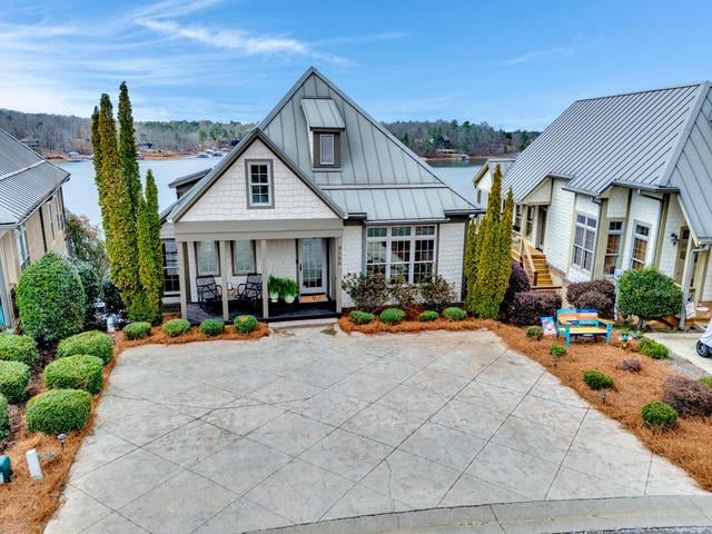
That last row matters for anyone looking at platted lake-area subdivisions rather than raw acreage. In places like the Harbor Light subdivision or Hidden Falls at Clear Creek, the covenants recorded for that specific subdivision, not the county, are what actually control minimum square footage, road standards, or architectural rules. Read them line by line, because they are doing the job zoning would normally do.
Does "no zoning" mean I can put anything I want on my Walker County land? Mostly, yes, outside the area around Bevill Field. Alabama has no statewide building code, and Walker County has no local building department to require permits or issue a Certificate of Occupancy. The tradeoff is that nothing is checking your work for you, including septic suitability and soil stability.
If mineral rights were severed decades ago, can someone start mining in my backyard? Under Alabama's dominant mineral estate doctrine, a mineral owner generally can access the surface to extract what they own, using reasonable methods, even without the surface owner's ongoing consent. This is exactly why confirming mineral ownership before you close matters more here than in most parts of the country.
How do I find out if a specific tract near Jasper was ever mined? Start with a mineral and surface title search back through the deed chain, then ask the seller directly. If mining history seems likely based on the land's location or appearance, a landman can request access to the state's mine map repository in Vestavia Hills to check specific parcels.
None of this makes land near Jasper a bad buy. Walker County remains one of the more affordable, flexible places in the state to build exactly the home or homestead you want, without a permit office slowing you down. It just means the due diligence that a permit process would normally handle for you has to happen on your side of the table instead, before you sign rather than after you break ground.
That is the kind of groundwork Deanna Parrish has spent 35 years doing, first in oil, gas, and mineral acquisitions, now as a Registered Professional Landman and REALTOR® serving Jasper and the Smith Lake region. If you are looking at acreage in Walker County and want someone to check the mineral history and mining record before you make an offer, not after, Contact Me Now.



Whether you are buying a home in town or a retreat on Smith Lake, Deanna is your local connection. She leverages deep community roots to find properties that perfectly match your lifestyle. Connect with her to start your journey.